 ABot-Earth 0.5
Free
ABot-Earth 0.5
Free
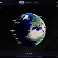
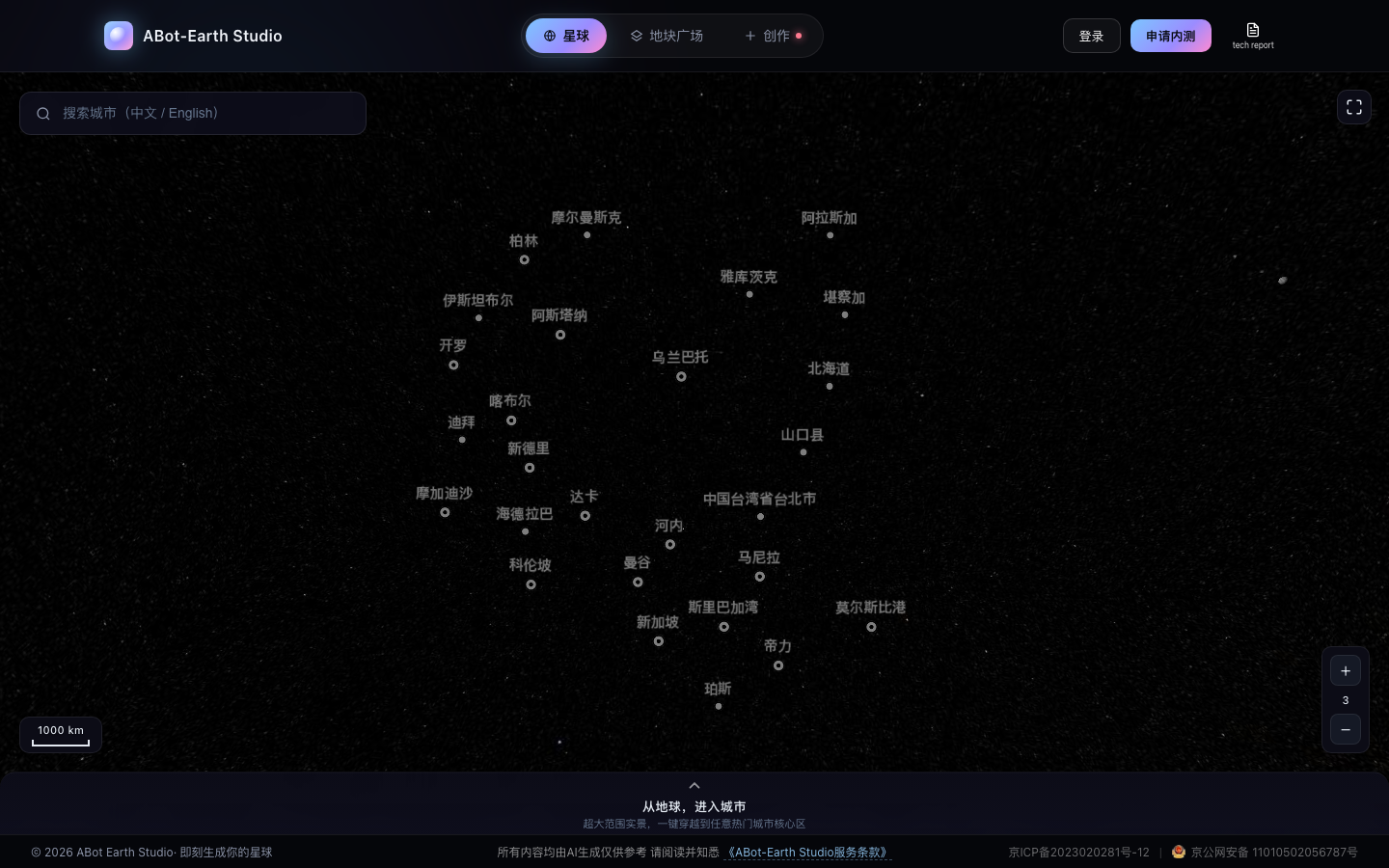
ABot-Earth 0.5 is the world's first 3D native city world model launched by Alibaba AutoNavi. Input a single satellite image or text description, generate a kilometer-level high-precision 3D urban scene in 10 minutes on a consumer-grade GPU, output an editable 3DGS format, and directly import it into Unity/UnrealEngine. Covering 190+ countries and regions.
ABot-Earth 0.5
Core parameters and statistics of ABot-Earth 0.5
ABot-Earth 0.5 is a native 3DGS generative earth model launched by AMap CV Lab, a subsidiary of Alibaba AutoNavi. It is officially positioned as "Generative 3D Earth Model". It is not a traditional 3D modeling software, but a 3D urban world model with generative AI as the core - input a single satellite image or text description, generate a kilometer-level high-precision 3D urban scene on a consumer-grade GPU within 10 minutes, and directly output the editable 3D Gaussian Splatting (3DGS) format.
| Projects | Public Information |
|---|---|
| Official positioning | Generative 3D Earth Model (generative 3D Earth model) |
| Core architecture | Native 3DGS generation framework + compression-generation paradigm |
| Input mode | Single satellite image / text description |
| Generation speed | ~10 min/km2 (consumer GPU, such as RTX 3090/4090) |
| Production-level throughput | Single Tile (~2.56 km²) in about 25 minutes (A100 GPU); 1000-card cluster completes global built-up area in 10 days |
| Coverage | 300+ cities, 190+ countries and regions |
| Output format | Native 3D Gaussian Splatting (3DGS), supports LOD levels |
| Engine compatible | Unity, Unreal Engine, supports OGC 3D Tiles standard |
| Data size | ~3.2 trillion Gaussian primitives (global built-up area) |
| Open source license | GitHub public repository (amap-cvlab/ABot-Earth-0.5), including technical reports |
| Community size | GitHub 184 stars, 11 forks, 2 watchers (as of 2026-07) |
| Latest version | v0.5 (~2026-06) |
| Technical Report | arXiv 2606.09967 + GitHub tech-report.pdf |
| Developer | AMap CV Lab, Alibaba AutoNavi |
Brief review in one sentence: ABot-Earth is not another 3D modeling software, but turns the earth into a "generable 3D canvas" - kilometer-level city modeling that used to take months and a professional team to complete can now be completed with a satellite image + a consumer-grade graphics card + 10 minutes.
Type determination: The main type is [Basic large model/API infrastructure] - it is an end-to-end 3D city generation model, and the core deliverable is a generative 3DGS scene. At the same time, it is delivered to end users in the form of [productivity/business-side application] through Web Studio (ABot-Earth Studio). The following in-depth analysis covers this dual type.
Users and market recognition of ABot-Earth 0.5
ABot-Earth 0.5 will be publicly released around June 2026 and is developed by Alibaba Amap AMap CV Lab. Its market recognition can be evaluated from three levels: academic impact, industry attention, and community verification.
Academic Impact: The technical report is publicly available on arXiv (2606.09967) and included in Hugging Face Papers. The paper proposes a native 3DGS generation framework, which significantly exceeds the previous optimal baseline (EarthCrafter's 69.5) with a FID index of 16.1, and the KID drops from 0.061 to 0.006. This is the first generative method to achieve this level of performance on real-world 3DGS reconstruction data.
Industry Attention: As AutoNavi’s cutting-edge product in the 3D field, ABot-Earth is naturally backed by AutoNavi’s global map data and Alibaba’s infrastructure resources. The internal testing phase has opened applications for game studios and digital twin teams. Its YouTube demo video provides a complete demonstration of the generated effects.
Open source community verification: The GitHub repository provides a complete technical report (tech-report.pdf), and the open source agreement is public. Although 184 stars and 11 forks is not a large-scale open source project, as a release from a corporate research laboratory, its focus is on technology disclosure rather than community co-construction. The two contributors (qianmingduowan, frankjiang) are both core members of AMap CV Lab.
Uniqueness of market positioning: Unlike Google Earth’s traditional photogrammetry reconstruction Marble’s procedural generation, ABot-Earth is the first technical route to “generate native 3DGS end-to-end based on real satellite images”. While Google Earth's 3D coverage is limited to sparse scanned urban areas, ABot-Earth can generate 3D scenes directly from satellite imagery in areas with no scanned data, such as rural Ireland.
Cost Advantages of ABot-Earth 0.5
ABot-Earth's cost advantage needs to be dismantled from two dimensions: technical route substitution and deployment level, rather than simply comparing subscription prices.
Alternative technical route: generative vs traditional photogrammetry
| Comparative dimensions | Traditional photogrammetry (Google Earth method) | ABot-Earth 0.5 (generative) |
|---|---|---|
| Data collection | Oblique photography / LiDAR scanning, takes several months | Single satellite image (available around the world) |
| Cost per square kilometer | Tens to hundreds of thousands of dollars | ~1% of traditional methods (technical report data) |
| Processing cycle | Weeks to months | 10 minutes to generate / 25 minutes for production-grade tiles |
| Team requirements | Professional surveying and mapping team + GPU cluster | Single person + consumer GPU |
| Coverage consistency | Only scanned urban areas | Satellite image coverage can be generated |
| Output editability | Closed format, export restricted | Native 3DGS, importable into Unity/UE |
C-side/individual developers: Apply to use Web Studio for free during the internal testing period. You need to bring your own consumer-grade GPU (RTX 3090/4090 level) for local inference. Single scene generation only consumes electricity and GPU depreciation, with very low explicit costs. The commercial authorization boundary is not disclosed in the internal testing terms, and the commercial use rights of the generated assets need to be confirmed before use.
API/Developer: Standalone API pricing is not disclosed at this time. During the internal testing phase, Web Studio (abot-earth.amap.com) is used as the delivery portal, and no independent SDK or REST API is provided. We plan to pay attention to whether Amap will open API channels in the future.
Enterprise/Game Studio: For teams that need to batch generate scenes, the cost of GPU cluster deployment needs to be evaluated. Technical reports reveal that complete generation of the global built-up area (approximately 800,000 km²) takes approximately 10 days on a 1000-card A100 cluster. The actual cost is made up of GPU computing power, data transfer, and storage. Compared to traditional outsourced modeling (thousands to tens of thousands of dollars per square kilometer), generative routing can compress costs to about 1%.
Hidden Costs: The most noteworthy hidden costs at this stage are the dependence of the generation quality on the resolution and clarity of the input satellite images. The 3DGS format may require additional conversion steps when integrated with the traditional game engine pipeline, as well as the commercial SLA and service stability that have not yet been clarified during the internal testing phase.
Main features of ABot-Earth 0.5
The capabilities of ABot-Earth 0.5 are designed around "end-to-end generation from satellite images to interactive 3D world". The core functions can be summarized into six categories:
- Single image/text generation 3D city: Input a single satellite image or natural language description to automatically generate kilometer-level high-precision 3D scenes. It supports starting from any coordinates on the earth, covering various landforms such as cities, suburbs, and natural terrain.
- Native 3DGS output: Directly output to 3D Gaussian Splatting format, preserving geometry, texture details and semantic information. Each scene is composed of millions of 3D Gaussian ellipsoids with color, transparency, rotation and covariance parameters, which are better at expressing non-manifold geometries such as leaves and water than traditional meshes.
- Multi-LOD native generation: The model has a built-in LOD hierarchical structure during the generation phase instead of downsampling after generation. Supports smooth transition from planet-level overlooks to street-level details, and achieves real-time streaming rendering of trillions of Gaussian primitives on the YunJing rendering engine.
- Engine integration and editability: The generated 3DGS scene can be directly imported into mainstream engines such as Unity and Unreal Engine, supporting editing, combination and secondary creation. Technical report demonstrating the integration of COLMAP-reconstructed high-accuracy landmark models (Eiffel Tower, Colosseum, etc.) into a generative contextual hybrid workflow.
- Sliding window seamless inference: Adopt a sliding window inference strategy to perform intelligent fusion in the transition area of adjacent generated blocks to eliminate splicing artifacts and ensure visual continuity of large-scale scenes. A single inference block covers 1.6 km × 1.6 km (4K satellite image input), and the internal sliding window is generated in units of 200 m × 200 m training tiles.
- Cross-domain condition adaptation: Through the condition adaptation mechanism driven by VLM (Visual Language Model), it handles the huge differences in resolution, shooting angle, atmospheric conditions, etc. of global satellite images. The training phase uses simulated satellite perspectives to render data, and the inference phase uses VLM to dynamically adapt to real satellite inputs.
Expert View: The ingenuity of ABot-Earth's design lies in "generation as a service" rather than "generation and then exporting". Its native multi-LOD capabilities mean users don’t have to invest extra in rendering optimization – a streamable hierarchy is available from the moment of generation, which solves the most time-consuming post-optimization issues in traditional 3D reconstruction. In addition, the use of satellite images as input conditions enables the rapid establishment of 3D digital basemaps in areas without aerial surveying and mapping capabilities (developing countries, remote areas), which is a structural blind spot in photogrammetry solutions such as Google Earth.
Model and version evolution of ABot-Earth 0.5
The version structure of ABot-Earth is currently relatively concise and is in the early stage of rapid iteration:
Mainline release
- v0.1 (~2025-06) — Early Preview: ABot-Earth preview. Verification of basic 3D city generation capabilities. The technical route for 3DGS characterization + satellite image condition generation was established. There is currently no public independent deployment version.
- v0.5 (~2026-06) — Current latest version: ABot-Earth 0.5. The core breakthrough lies in three aspects - proposing a native 3DGS generation framework (rather than converting to 3DGS after generation); realizing the endogenous generation of multiple LOD levels; and building a global production pipeline that can cover 190+ countries and 300+ cities. The technical report and GitHub repository are made public, and Web Studio internal testing is launched.
The approximately one-year gap between the two versions reflects the huge workload from algorithm verification to engineering deployment: including systematic projects such as the ABot-3DGS reconstruction pipeline, global multi-source data scheduling, and the construction of the trillion-level rendering engine (EarthScape).
Version Rhythm Judgment: As a result of the Amap Research Laboratory, ABot-Earth's release rhythm is similar to "milestone major releases" rather than "continuous small steps". The maturity of v0.5 has surpassed the academic demo stage and entered the productization stage that can be tested internally. The next version is expected to advance in three directions: generation resolution improvement, ground-level (street-view) detail generation, and commercial API opening. The technical report clearly lists "from sky to ground" as the next stage goal.
Technical advantages of ABot-Earth 0.5
The technical advantages of ABot-Earth need to be understood from the unique positioning of "generative 3D earth model", rather than compared with general 3D generative models (such as TRELLIS, Hunyuan3D). The following analyzes the four core technological innovations according to the chain of "mechanism → effect → applicable scenarios".
Native 3DGS generation framework: avoiding the detour of "first grid and then format"
Mechanism: Most existing 3D generative models are represented by mesh or NeRF as output, and exporting to 3DGS requires additional conversion steps. ABot-Earth directly learns the latent space of 3DGS within a compression-generation paradigm—first compressing real-world million-level 3DGS scenes into compact latent vectors, and then training a diffusion model in the latent space to generate new 3DGS scenes.
Effect: The generated 3DGS scene can be used directly for rendering and editing without format conversion. Compared with mesh-based solutions, 3DGS expresses complex geometries such as leaves, water surfaces, and glass curtain walls more naturally, and naturally supports differential rendering.
Applicable scenarios: Scenarios that require high-frequency iteration (rapid prototyping of game development, rapid construction of digital twins), and teams that need to interface with existing 3DGS workflows (such as Unity/UE plug-ins).
Endogenous multiple LOD levels: rendering efficiency does not depend on post-optimization
Mechanism: The decoder produces a multi-level 3DGS structure (zoom 14-19) when it is generated, instead of first generating a complete high-precision model and then downsampling. High-precision layers (zoom 17-19) are natively output by the generative model, and low-precision layers (zoom 14-16) are generated by Bhattacharyya distance-guided statistical downsampling, which can be executed in parallel on the CPU.
Effect: Supports continuous zooming from global bird's-eye view to street level. The YunJing rendering engine dynamically schedules the corresponding LOD levels according to the viewport, achieving a real-time interactive frame rate of trillions of primitives. It avoids the bottleneck of "high-precision models that are too large to be rendered in real time" in traditional pipelines.
Applicable scenarios: Applications that require interactive browsing of large-scale 3D scenes (Web maps, digital twin city command centers, drone route planning).
Sliding window seamless reasoning: solves the splicing problem of "large scene generation"
Mechanism: The training phase is measured in tiles of 200 m × 200 m, and the inference phase is measured in blocks of 1.6 km × 1.6 km. In the overlapping areas of adjacent generated blocks, boundary artifacts are eliminated through an intelligent weight fusion strategy.
Effect: The coverage area of a single inference block is 64 times that of the training tile, significantly reducing the number of inferences required for full scene generation. And the boundary fusion effect reaches an "almost seamless" visual level in subjective evaluations (technical report Fig. 4).
Applicable scenarios: Projects that require continuous large-scale 3D context (city-level digital twins, autonomous driving simulation, low-altitude economic airspace management).
Cross-domain condition adaptation: turning "unstable satellite image quality" into a design advantage
Mechanism: In the training phase, the "simulated satellite perspective" image is rendered from the 3DGS scene as a condition; in the inference phase, VLM is used to analyze the shooting angle, atmospheric conditions, resolution and other characteristics of the real satellite input, and dynamically adapt the generated parameters.
Effect: The model is robust to satellite images from different sources and qualities. In areas where Google Earth lacks 3D data (such as rural Ireland), ABot-Earth can still generate reasonable 3D scenes containing buildings, roads, and vegetation.
Applicable scenarios: Global coverage projects with uneven satellite image quality, or applications that need to quickly establish 3D basemaps for areas without surveying and mapping data.
Technical comparison with competing products:
| Dimensions | Google Earth | Marble (Procedural Generation) | CityDreamer / EarthCrafter | ABot-Earth 0.5 |
|---|---|---|---|---|
| Technical route | Oblique photogrammetry + manual post-processing | Procedural rule generation | Diffusion model generation and 2D view reconstruction | Native 3DGS generation |
| Data dependence | Requires multi-angle oblique photography | No real data required | Training data required | A single satellite image is enough |
| Coverage | Only sparse urban areas | Unlimited but not real | Limited area | Satellite image coverage is sufficient |
| Generation speed | Months to years | Instant but not real | Minute level (limited area) | ~10 min/km² |
| Output format | Closed format | Engine-specific | 2D view/mesh | Native 3DGS |
| Editability | Limited | Parametric | Low | High (3DGS direct editing) |
| Visual Quality Rating | Geometry/Textures High, Aesthetics Medium | Visual Rules Quality | FID 69.5 (EarthCrafter) | FID 16.1 |
How to use ABot-Earth 0.5
ABot-Earth currently uses internal testing Web Studio as the main delivery portal, and the usage path is as follows:
| Entrance | Access method | Suitable for the crowd | Prerequisites |
|---|---|---|---|
| Web Studio (main entrance) | abot-earth.amap.com → Apply for internal testing | All users | Passed internal testing application + desktop browser (WebGL support) |
| World exploration (default scene) | abot-world.amap.com | Browsing users | No need to apply, you can directly explore the preset 3D city |
| Technical report and code | GitHub: amap-cvlab/ABot-Earth-0.5 | Researchers/Developers | Need to configure inference context and GPU by yourself |
| Local inference (internal beta) | Internal beta users have the right to restart local inference | Developers with GPUs | Consumer GPU (RTX 3090/4090) + internal beta qualifications |
Typical usage process (Web Studio):
- Visit abot-earth.amap.com and click "Login to apply for internal testing" to submit the application
- After passing the review, enter Studio and select "Instant Creation" mode
- Select the input method: upload satellite images or enter text description (such as "Generate a 3D city of Shinjuku, Tokyo")
- Wait about 10 minutes (consumer GPU) to complete the generation
- Check the generated results in the 3D preview window, supporting scaling, rotation, and translation
- Download the generated 3DGS format assets and import them into Unity, Unreal Engine or other tools that support 3DGS
Expert Tip: At this stage, it is recommended to first understand the generation quality and coverage level through the "World Exploration" function (abot-world.amap.com) before applying for internal testing. Since Web Studio is based on WebGL, desktop Chrome/Edge has the best experience. The internal beta qualification approval speed and SLA are subject to the official actual process.
Product Pricing for ABot-Earth 0.5
ABot-Earth is currently in the internal testing stage, and public pricing information is limited, but it can be disassembled into three layers based on product form:
- C client/individual users: Use Web Studio to generate scenarios for free during the internal beta period. You need to bring your own consumer-grade GPU for local inference (Web Studio completes AI inference for the client in the cloud, but local inference requires your own graphics card). Free quota, generation times and resolution limits are subject to the internal beta terms.
- Developers/Researchers: GitHub warehouse and technical reports are free and open to the public, and can be reproduced or re-developed based on technical reports. API opening hours and pricing strategy have not been announced.
- Enterprise/Game Studio: Commercial pricing to be announced. Judging from the technical report that the 1000-card A100 cluster can complete global generation in 10 days, the price of enterprise-level batch generation will be based on GPU computing power consumption + data usage authorization. It is currently recommended to contact the AutoNavi team through the internal beta channel to obtain a business quotation.
Cost benchmarking with traditional modeling (deduction reference, unofficial data):
- Traditional method: Outsourcing cost for a single square kilometer of urban 3D modeling is approximately US$5,000–50,000, with a cycle time of 2–8 weeks
- ABot-Earth generative path: GPU computing cost (in cloud GPU terms) ~$50–200/km² + 10 minutes of generation time
- Core cost reduction source: Eliminating the process of field surveying, manual modeling, and multiple rounds of modifications, reducing the labor part of the cost to almost zero
Application scenarios of ABot-Earth 0.5
ABot-Earth's application scenarios focus on areas that "require fast, low-cost, large-scale 3D urban spatial data" rather than general 3D modeling.
- Game Development - Open World Basemap Generation: Use satellite images to generate open world city basemaps, replacing traditional manual modeling or procedural generation. The benefits are reflected in two levels - first, the city-level scene construction is compressed from "months" to "days"; second, the generated results are based on real geographical data, which is naturally spatially rational, reducing the workload of the art team in "fabricating city layout". Key points for acceptance: whether the generated building layout conforms to the real road network and whether the texture style matches the game art style.
- Embodied Intelligence/Autonomous Driving Simulation: Provides high-precision 3D urban training context for unmanned aerial vehicles (UAV) and autonomous vehicles. The scenes generated by ABot-Earth are physically realistic and multi-perspective consistent, and can replace real aerial photography data in closed simulations. The technical report explicitly lists enclosed UAV navigation as an applied Embodied AI scenario. Key points for acceptance: Whether the geometric accuracy of rendering meets the requirements of Sim-to-Real migration and the fidelity of sensor simulation.
- Low-altitude economy and airspace management: A three-dimensional digital base map that supports UAV route planning, airspace conflict detection, and emergency landing point assessment. The low-altitude economy requires a 3D map covering the entire city (rather than just a few routes), and ABot-Earth’s generative path solves the coverage problem. Key points for acceptance: accuracy of building height estimation, completeness of detection of obstacles (telephone poles, trees).
- Digital Twin City: Rapidly build a city-level digital twin base. Traditional methods require months to years of data collection and modeling cycles, but ABot-Earth can compress the "first mapping" time to a few days. It is suitable for scenarios such as urban planning, emergency management, and environmental monitoring that require frequent updates of 3D base maps. Key points for acceptance: ease of integration with GIS systems (such as Cesium) and predictability of update cycles.
- **Film and television production and virtual production
Film**: Generate digital twin scenes of real urban backgrounds, replacing live shots or pure CGI construction. The generated 3DGS scene can be used as a contextual basemap for virtual production and supports real-time camera roaming. Key points for acceptance: Compatibility of the output format with the UE/Unity pipeline. Whether LOD switching affects the real-time rendering frame rate.
Scene Adaptation Matrix:
| Scenario | Recommendation | Core indicators | Acceptance concerns |
|---|---|---|---|
| Game open world base map | ★★★★★ | Generation speed, scene scale | Rationality of building layout, engine compatibility |
| Embodied intelligent simulation | ★★★★★ | Geometric accuracy, multi-view consistency | Sim-to-Real transfer effect |
| Low-altitude economic airspace management | ★★★★☆ | Coverage, building height accuracy | Obstacle completeness, coordinate system alignment |
| City digital twin | ★★★★☆ | Update frequency, integration with GIS | LOD switching fluency, data format |
| Film and television virtual production | ★★★☆☆ | Visual quality, real-time frame rate | Art style controllability, modification flexibility |
Applicable people for ABot-Earth 0.5
ABot-Earth serves the user group who need "large-scale 3D scenes" rather than "single 3D assets", and its applicable boundaries are relatively clear.
- Game Studio (Open World Direction): A team that needs to quickly build a contextual base map of a real city. ABot-Earth can replace the traditional process of "manual construction with reference to real cities". But please note: the generated scenes are "realistic" rather than "stylized", and art pipelines with non-realistic rendering styles such as cartoons and low polygons require additional rendering work.
- Digital Twin and GIS Team: A team that needs to build 3D digital base maps for cities, parks, and transportation hubs. The value of ABot-Earth lies in reducing the first modeling cycle from "months" to "days", and it has the natural ability to align geographical coordinates. However, the "absolute accuracy" of generative scenes is not as good as laser scanning reconstruction, and it needs to be mixed and superimposed with high-precision BIM data.
- Autonomous Driving Simulation Engineer: Diverse and generalizable 3D urban scenes are needed to train and verify perception algorithms. ABot-Earth can cover the landforms and architectural forms of different countries and urban styles. However, the current version is mainly based on aerial photography perspective, and ground-level (street-level) detail generation is the clear next goal (Technical Report §6). It is currently more suitable for simulation tasks based on "aerial photography perspective planning".
- UAV and low-altitude economic team: A three-dimensional map covering the entire city is needed to support route planning and airspace management. ABot-Earth's global coverage capabilities and minute-level generation speed solve the "coverage dead spots" problem of traditional solutions.
- Research and Educational Institutions: Need large-scale 3D urban data for academic research (urban computing, remote sensing, embodied intelligence). Technical reports and GitHub repositories provide complete theoretical foundations and reproduction clues.
Dissuaded/not applicable to people:
- Solo 3D Asset Creator: For teams that don’t need a city-level scene, but only need a single building or object, ABot-Earth is not the right tool. Such requirements are more suitable for object-level generative models such as TRELLIS and Hunyuan3D.
- Surveying projects requiring centimeter-level accuracy: ABot-Earth's generative scenes perform well at the "visually reasonable" level, but cannot reach the centimeter-level standard of laser scanning or oblique photography reconstruction in terms of absolute geometric accuracy. Scenarios such as engineering surveying and as-built measurement still require traditional measurement methods.
- Projects that heavily rely on specific art styles: The scenes generated by ABot-Earth reflect the "style of real satellite images". If the project requires a specific art style (cyberpunk, ink style, low polygon), additional post-stylization processing is required.
- Individual users without GPU resources: While Web Studio can run inference in the cloud, local deployment and batch builds still require a consumer-grade GPU. Without a GPU the user experience is limited.
Summary and Outlook of ABot-Earth 0.5
ABot-Earth 0.5 reduces the technical threshold and cost of 3D city modeling by two orders of magnitude. It is not a "faster 3D modeling tool", but redefines the path of "how to get a 3D city" - from "mapping + reconstruction" to "description + generation". Its core differentiation lies in three points: the native 3DGS representation brings the advantage of a ready-to-use format, the endogenous LOD structure solves the real-time rendering problem of trillion-level scenes, and the ability to achieve generalized coverage of any coordinates around the world based on satellite image conditions.
Current Limitations and Uncertainties:
- Uncertainty in the internal testing phase: Web Studio is in the internal testing period. The application approval speed, generation quota, and service SLA are all based on the official actual process. There are no public commercial terms yet.
- Generation quality depends on input: In areas with low satellite image resolution, cloudy coverage, and severe shadows, the generation quality will decrease significantly. During the internal testing phase, it is recommended to start with high-quality satellite image areas (urban core areas) for evaluation.
- Ecological maturity of the 3DGS format: Although 3DGS is rapidly gaining popularity in the academic community, native support for mainstream game engines (Unity, UE) is still under construction. Importing into traditional pipelines may require additional format conversion plugins or runtime libraries.
- Commercial authorization boundary is not clear: The commercial use rights terms, copyright ownership and redistribution rules of the generated assets were not disclosed during the internal testing phase. The scope of authorization must be confirmed through Amap before commercial use.
- Ground-level details are temporarily missing: The current version is mainly based on the aerial/satellite view (oblique aerial view), and ground-level street-level details are the next clear goal.
Procurement/Adoption Risk Assessment:
- Short-term (0–6 months): It is recommended that game studios and digital twin teams apply for experience through the internal beta channel. Focus on verifying the generation quality, engine compatibility and iteration efficiency improvement under your own business scenarios. Don’t rely solely on products in your production pipeline that are still in beta.
- Mid-term (6–12 months): Pay attention to whether AutoNavi opens API/SDK, launches enterprise version pricing, and the progress of 3DGS native support in Unity/UE. If ABot-Earth has a clear commercialization path (such as pricing based on generated area, providing privatized deployment), it can be fully adopted in low- and medium-risk projects.
- Long term (12 months+): With improvements in ground-level detail, higher resolution output, and scene editing capabilities, ABot-Earth has the potential to become the standard "3D scene base layer" for digital twins and game development. Before purchasing, enterprises need to confirm: the intellectual property ownership of the generated data, the availability commitment in the commercial SLA, and AutoNavi's long-term commitment to this product.
Related tools:  Midjourney, stable-diffusion
Version Info
- ABot-Earth 0.5 :Supports single image/text generation of 3D cities, 10 minutes of consumer-grade GPU inference, and 3DGS format output, covering 190+ countries.
- ABot-Earth preview :Early preview version, verification of basic 3D city generation capabilities.
User Reviews